![](/images/other/stat-length.png)
![Trail On foot Hofkirchen im Traunkreis - Wanderweg Lanzenberg - Photo](https://media.geolcdn.com/t/1900/400/fad5c2cb-e5de-41fe-8d11-38975e3cd9db.jpeg&format=pjpeg&maxdim=2)
Wanderweg Lanzenberg
SityTrail - itinéraires balisés pédestres
Tous les sentiers balisés d’Europe GUIDE+
![Length](/images/other/stat-length.png)
Length
5.5 km
![Max alt](https://static1.geolcdn.com/siteimages/upload/files/1508320355ic_sort_altitude_max_24dp.png)
Max alt
337 m
![Uphill gradient](https://static1.geolcdn.com/siteimages/upload/files/1508320355ic_sort_den_pos_24dp.png)
Uphill gradient
100 m
![Km-Effort](/images/other/stat-length.png)
Km-Effort
6.8 km
![Min alt](https://static1.geolcdn.com/siteimages/upload/files/1508320355ic_sort_altitude_min_24dp.png)
Min alt
282 m
![Downhill gradient](https://static1.geolcdn.com/siteimages/upload/files/1508320355ic_sort_den_neg_24dp.png)
Downhill gradient
99 m
![Boucle](https://static1.geolcdn.com/siteimages/upload/files/16400158638029165_repeat_loop_refresh_sync_direction_icon.png)
Boucle
Yes
Signpost
Creation date :
2022-02-16 16:20:44.084
Updated on :
2022-03-03 05:39:33.192
![On foot](https://static1.geolcdn.com/sitytour/trail-icons/100.png)
1h33
Difficulty : Easy
![Scan this QR Code to open this trail in the SityTrail application](https://capi.geolives.com/qq0zvz2zws4bq2lad0pu/sitytour/trails/3126646/qr.png?size=200)
FREE GPS app for hiking
About
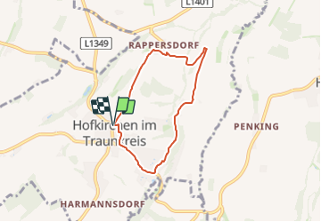
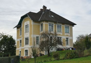
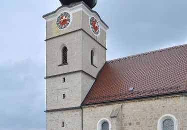
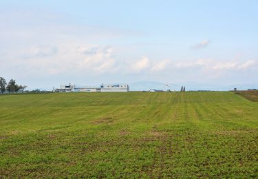
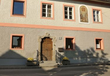
Trail On foot of 5.5 km to be discovered at Upper Austria, Bezirk Linz-Land, Hofkirchen im Traunkreis. This trail is proposed by SityTrail - itinéraires balisés pédestres.
Description
Symbol: Weißer Text auf grünem Pfeil "Wanderweg Lanzenberg" mit Symbol für Wanderer
Positioning
Country:
Austria
Region :
Upper Austria
Department/Province :
Bezirk Linz-Land
Municipality :
Hofkirchen im Traunkreis
Location:
Unknown
Start:(Dec)
Start:(UTM)
453769 ; 5332343 (33U) N.
Comments
Trails nearby
![Trail On foot Niederneukirchen - Wanderweg 5 Kapellen und Wegkreuze - Photo](https://media.geolcdn.com/t/375/260/b93fa360-269f-445e-8413-0e5f4f5c3754.jpeg&format=jpg&maxdim=2)
![On foot On foot](https://static1.geolcdn.com/sitytour/trail-icons/100.png)
Wanderweg 5 Kapellen und Wegkreuze
On foot
Easy
Niederneukirchen,
Upper Austria,
Bezirk Linz-Land,
Austria
![](/images/other/stat-length.png)
6 km | 7.4 km-effort
1h 40min
![](https://static1.geolcdn.com/siteimages/upload/files/16400158638029165_repeat_loop_refresh_sync_direction_icon.png)
No
![Trail On foot Niederneukirchen - Wanderweg 4 Steggraben-Ruprechtshofen - Photo](https://media.geolcdn.com/t/375/260/718ae45c-070d-400e-99b5-7d59f21b383d.jpeg&format=jpg&maxdim=2)
![On foot On foot](https://static1.geolcdn.com/sitytour/trail-icons/100.png)
Wanderweg 4 Steggraben-Ruprechtshofen
On foot
Easy
Niederneukirchen,
Upper Austria,
Bezirk Linz-Land,
Austria
![](/images/other/stat-length.png)
9.5 km | 11.7 km-effort
2h 39min
![](https://static1.geolcdn.com/siteimages/upload/files/16400158638029165_repeat_loop_refresh_sync_direction_icon.png)
Yes
![Trail On foot Hofkirchen im Traunkreis - Wanderweg Krottental - Photo](https://media.geolcdn.com/t/375/260/a4d92969-9284-418c-a99c-f13c6a9f1a6c.jpeg&format=jpg&maxdim=2)
![On foot On foot](https://static1.geolcdn.com/sitytour/trail-icons/100.png)
Wanderweg Krottental
On foot
Easy
Hofkirchen im Traunkreis,
Upper Austria,
Bezirk Linz-Land,
Austria
![](/images/other/stat-length.png)
6.9 km | 8.1 km-effort
1h 50min
![](https://static1.geolcdn.com/siteimages/upload/files/16400158638029165_repeat_loop_refresh_sync_direction_icon.png)
Yes
![Trail On foot Hargelsberg - Ortschaftenweg - Photo](https://media.geolcdn.com/t/375/260/266f870f-55f4-4533-96af-df55d6da3eab.jpeg&format=jpg&maxdim=2)
![On foot On foot](https://static1.geolcdn.com/sitytour/trail-icons/100.png)
Ortschaftenweg
On foot
Easy
Hargelsberg,
Upper Austria,
Bezirk Linz-Land,
Austria
![](/images/other/stat-length.png)
12 km | 14.5 km-effort
3h 18min
![](https://static1.geolcdn.com/siteimages/upload/files/16400158638029165_repeat_loop_refresh_sync_direction_icon.png)
Yes
![Trail On foot Niederneukirchen - Wanderweg 6 Rund um den Kirchturm - Photo](https://media.geolcdn.com/t/375/260/ce002758-d35a-4536-bf98-c3e96d4fe7a4.jpeg&format=jpg&maxdim=2)
![On foot On foot](https://static1.geolcdn.com/sitytour/trail-icons/100.png)
Wanderweg 6 Rund um den Kirchturm
On foot
Easy
Niederneukirchen,
Upper Austria,
Bezirk Linz-Land,
Austria
![](/images/other/stat-length.png)
3.4 km | 4.3 km-effort
58min
![](https://static1.geolcdn.com/siteimages/upload/files/16400158638029165_repeat_loop_refresh_sync_direction_icon.png)
No
![Trail On foot Niederneukirchen - Wanderweg 2 Kühholz - Photo](https://media.geolcdn.com/t/375/260/31bae9c3-2b36-49c8-b761-a30d25f285cd.jpeg&format=jpg&maxdim=2)
![On foot On foot](https://static1.geolcdn.com/sitytour/trail-icons/100.png)
Wanderweg 2 Kühholz
On foot
Easy
Niederneukirchen,
Upper Austria,
Bezirk Linz-Land,
Austria
![](/images/other/stat-length.png)
5.5 km | 6.6 km-effort
1h 29min
![](https://static1.geolcdn.com/siteimages/upload/files/16400158638029165_repeat_loop_refresh_sync_direction_icon.png)
Yes
![Trail On foot Wolfern - Wanderweg Hagleiten - Photo](https://media.geolcdn.com/t/375/260/648b83e5-8153-4adf-9b37-2410fae9e744.jpeg&format=jpg&maxdim=2)
![On foot On foot](https://static1.geolcdn.com/sitytour/trail-icons/100.png)
Wanderweg Hagleiten
On foot
Easy
Wolfern,
Upper Austria,
Bezirk Steyr-Land,
Austria
![](/images/other/stat-length.png)
10.8 km | 13.1 km-effort
2h 58min
![](https://static1.geolcdn.com/siteimages/upload/files/16400158638029165_repeat_loop_refresh_sync_direction_icon.png)
Yes